|
||
 |
 |
|
|
|
||
|
|
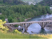
The incorporated City of Myrtle Creek and the unincorporated Tri City area just south of the City are located adjacent to Interstate 5 approximately halfway between the metropolitan cities of Eugene and Medford, Oregon.Settlers first came to the valley in 1837 and by the 1850's farmlands and homesteads (Donation Land Claims) were established in the area. It was gold however, that brought settlers north from California to the rich valleys along the South Umpqua River and the forks of Myrtle Creek. The City of Myrtle Creek incorporated in 1893. The population was 3,419 at the 2000 census. An equal population has settled in the outlying rural areas to the east and northeast (North Myrtle and South Myrtle). The unincorporated community of Tri City to the south had a population of 3,519 at the 2000 census. Centrally located, Tri City lies in an oblong valley between the cities of Myrtle Creek, Riddle and Canyonville. This area is serviced by the Tri City Water & Sewer District and is the location of the Myrtle Creek Municipal Airport (also call French Field) and the main office for South Umpqua School District, both of which serve the larger surrounding area. The Myrtle Creek ~ Tri City area is a mix of old and new subdivisions, business districts and rural properties speckled with horse pastures and hay fields. A new Industrial Park is being developed adjacent to the Interstate interchange at the south end of Tri City, where there's plenty of room for expansion. View Local Street MapsClick here to view local street maps Note: Link opens in new window. Read more.... |
Business of the Month
Promotional VideoInformation Center |
| ©2010 Myrtle Creek~Tri City Area Chamber of Commerce P.O. Box 31, Myrtle Creek, Oregon 97457 | Phone:541-863-3037 |
||

